Hull Maps and Orientation
(Kingston Upon Hull, East Riding of Yorkshire, England, UK)
Situated just 40 km / 25 miles from the eastern coastline of the North Sea, the city of Kingston Upon Hull is based around the River Hull and the Humber Estuary. Hull lies in northern
England and is a fairly flat city and is part of the country known as East Riding of Yorkshire.
Hull is a great place to base yourself if you want to explore Yorkshire, and close by are seaside resorts, market towns and beautiful countryside views, particularly around the Yorkshire Wolds, where the rolling chalky hills are a major draw card. Just over 241 km / 150 miles to the north of
London, this vibrant university city has a definite youthful feel.
Maps and Orientation of the City
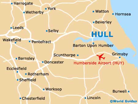
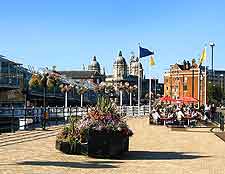
The historical Old Town area of the city is bordered by the Hull and Humber rivers, as well as the Freetown Way and the Ferensway. To the south you will find Hull Marina and the Deep aquarium attraction, which are both eminently walkable.
For maps of Hull, visit the TIC (Tourist Information Centre) on Carr Lane, which stands alongside the beautiful buildings that make up the Queen Victoria Square. The following destinations are within reach of Hull, by either road or rail:
- Barton Upon Humber - 18 km / 11 miles (20 minutes, south)
- Beverley - 19 km / 12 miles (22 minutes, north)
- Bradford - 109 km / 68 miles (one hour and 25 minutes, west)
- Bridlington - 51 km / 32 miles (45 minutes, north)
- Chesterfield - 120 km / 75 miles (one hour and 30 minutes, south-west)
- Cleethorpes - 54 km / 34 miles (45 minutes, south-east)
- Doncaster - 74 km / 46 miles (one hour and ten minutes, south-west)
- Driffield - 35 km / 22 miles (45 minutes, north)
- Easington - 192 km / 120 miles (two hours and 20 minutes, south-east)
- Filey - 63 km / 39 miles (one hour, north)
- Grimsby - 53 km / 33 miles (45 minutes, south-east)
- Halifax - 110 km / 69 miles (one hour and 25 minutes, west)
- Harrogate - 101 km / 63 miles (one hour and 20 minutes, north-west)
- Hornsea - 29 km / 18 miles (35 minutes, north-east)
- Huddersfield - 118 km / 74 miles (one hour and 35 minutes, west)
- Humberston - 59 km / 37 miles (50 minutes, south-east)
- Leeds - 99 km / 62 miles (one hour and 25 minutes, west)
- Lincoln - 74 km / 46 miles (one hour and ten minutes, south)
- Liverpool - 204 km / 127 miles (two hours and 30 minutes, west)
- Manchester - 154 km / 96 miles (one hour and 55 minutes, south-west)
- Mansfield - 125 km / 78 miles (one hour and 35 minutes, south-west)
- Nottingham - 147 km / 92 miles (one hour and 50 minutes, south-west)
- Pontefract - 72 km / 45 miles (one hour and ten minutes, west)
- Scarborough - 69 km / 43 miles (one hour and ten minutes, north)
- Scunthorpe - 46 km / 29 miles (40 minutes, south-west)
- Sheffield - 106 km / 66 miles (one hour and 25 minutes, south-west)
- Stoke on Trent - 201 km / 125 miles (two hours and 30 minutes, south-west)
- Wakefield - 88 km / 55 miles (one hour and 20 minutes, west)
- Watton - 26 km / 16 miles (30 minutes, north)
- Winterton - 27 km / 17 miles (30 minutes, south-west)
- Withernsea - 27 km / 17 miles (30 minutes, east)
- York - 72 km / 45 miles (one hour and ten minutes, north-west)
Map of the United Kingdom

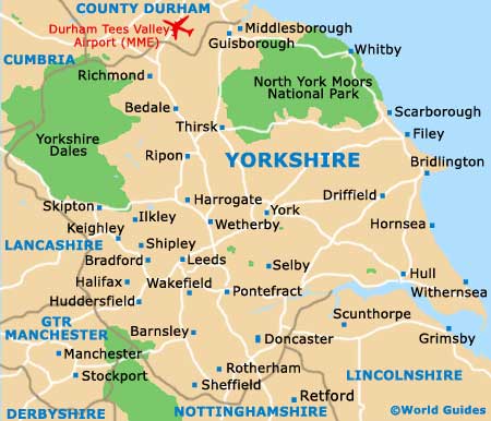
Map of Yorkshire
Map of East Riding of Yorkshire

Map of Hull